Shirley and I have been planning a road trip to Connecticut every since our oldest son Erik was stationed there in the Navy and decided to stay when his enlistment was completed. Maybe that was because he married a girl from there. We have flown to visit many times but had always wanted to see the country between Idaho and the east coast (you don't see much from 30,000+ feet in the air or in the area around airports. So as part of Shirley's planning for her retirement as Mackay Library Director after 26 years, we planned our long awaited road trip. We were gone 30 days and traveled 6,665 miles through 21 different states (we were not on the road all the time, we spent 10 days with Erik, April and their boys in Connecticut).
Please note: the following pictures are of the area we were in and may not depict what the entire state may look like. For example if one were to travel through Idaho on the northern route one would see large lakes and the paloos (grassy rolling hills); traveling through the central part of the state one sees rugged high mountain peaks, roaring rivers, and narrow valleys; while traveling through southern Idaho one sees lava flows and desert.
If you stay on this post, you will travel with us in chronological order. If you want to jump to to different parts or our travel, just click on one of the links listed below.

August 27, 2015 and loading up. Here we go.


First Day, Wyoming and to Riverton to spend time with Terry and Donna
(Shirley's brother and sister-in-law)

Left to right: Dorothy (Shirley's mom-we took her as far as Riverton to spend time with relatives), Terry, Donna, and Shirley

Smoke from the forest fires in northern Idaho and California detracted from the view of the Grand Teton in Grand Teton Nation Park, the most photographed mountain peak in the U.S. (but not the highest peak in Wyo).

Between Moran Junction in Grand Teton National Park and Dubois, Wy, we traveled over Togwatee Pass, past high alpine meadows and the Pinnacles (odd shaped mountain peaks).

Leaving the forested mountains of the Wind River Mountains and Togwatee Pass we come to the typical red rocks of this part of Wyoming. This picture was taken south of Dubois with the Wind River in the foreground. Continuing toward Riverton and central Wy. we enter the Wind River Indian Reservation (Shoshone and Arapahoe).


Crow Heart Butte where locals say the battle between Chief Washakie and a Crow Chief took place which ended the war between the Shoshone and Crow. Good story.
We visited Chief Washakie's grave a year or so ago; but, that will be another post along with Sacajawea's grave.

Wyoming.
Today we will travel across Wyoming into South Dakota and Mount Rushmore.


Not a whole lot to take pictures of between Riverton and Casper; but north of Casper is Devil's Tower National Monument. We took a little detour to get this smoky view on our way to South Dakota.


We checked into our hotel in Rapid City, then drove to Mt. Rushmore. The lateness of the day and the lingering smoke from the Idaho and western forest fires, gives the monument a slightly different look.

Because it was late in the evening when we arrived, we decided to stay for the lighting of the monument. The National Park Service has a great presentation before lighting. The presentation includes the presenting of the colors by all veterans in the audience. When the flags are retired at the end of the lighting ceremony, each veteran is asked to introduce themselves (name, state, and branch of service). There were well over 100 veterans. It was very impressive and humbling. The Audience gave these veterans a rousing ovation.
Today we leave Rapid City, travel across South Dakota, and into Albert Lea, Minnesota. This will be a long day of travel.


The landscape of South Dakota eastward from Rapid City is much like the grasslands of north central Wyoming near KayCee and Buffalo.

After leaving Rapid City, we kept seeing signs for Wall Drug. These signs would show up every few miles for fifty miles (we even saw a few in eastern Wy. So we pulled off I70 to check it out. As you can see it is more than a drug store (it covers over 1/2 a city block).

This what it looks like inside Wall Drug (not in the Drug Store but in the mini-mall adjacent to it). There are quite a few shops that are part of the store.

Shirley met a new friend but he wasn't much for conversation.
We left Albert Lea, Minnesota this morning and will have another long day of travel; crossing the remainder of Minnesota, taking a detour into Iowa, traveling across Wisconsin, the north end of Illinois, through Chicago and into Elk Heart, Indiana where we will end our day.


Looking across the Missouri River in south central South Dakota. Lewis and Clark had a major camp in this location on their trek to the Pacific. On the west side of the river (far side) the country is mostly grassy ranch land. The east side (foreground) the landscape changes to flat farmland.


Landscape in Minnesota isn't much different in the western part of the state than it is in eastern South Dakota.


Minnesota or Iowa? We took a side trip into Iowa to get off I90 for a while as we traveled through Minnesota. Landscape is the same in this part of these two states.

The smoke from the western fires followed us all the way to the Mississippi River.

Crossing the Mississippi River near La Cross Wisconsin (river narrows here according to the map).

We didn't take any pictures of the Wisconsin landscape as it was just the same as what we had previously seen in Minnesota and Iowa

I had a hard time finding a new Green Bay Packers hat in Wisconsin. Who would have thought.

We didn't take any pictures in this part of Illinois. As you can see behind the sign, it is just more farm land and corn.

Here we go heading for Chicago. We decided we would take too much time to detour around the City; so, we bit the bullet on a Sunday afternoon at about 4:30 and away we went.


A left turn on I 90 and heading for Indiana.
Around the south end of Lake Michigan, across the north end of Indiana and into Ohio, traveling by Toledo and through Cleveland to the Rock and Roll Hall of Fame.

We spent the night at Elk Heart, Indiana eating at the Red Lobster. Leaving Elk Heart, we head for Ohio where will spend several days around the Cleveland area touring the Rock and Roll Hall of Fame, Amish Country, and LDS historical sites.


Rythm, Blues, Gospel, and Country were blended together in the late 1940's and early 1950's; but, the R & R Hall of Fame includes more than what I consider Rock and Roll. Most music genres Hip Hop, RAP (Retards Attempting Poetry), etc. which I and many others don't think is true R & R. The Hall of Fame has been criticized for not being true to Rock and Roll since it's creation in 1983.


Les Paul was father of the electric guitar. He and Mary Ford (his wife) were also early contributors to the Rock and Roll movement with songs like "Tiger Rag" (Hold that Tiger). I remember them well as I was about 5 years old.


Sign says that this motor cycle belonged to Elvis. He may have owned it, but I would bet money that he didn't put any miles on.

Nope, not Elvis but his cousin Jerry Lee Lewis, "Great Balls of Fire" another early R & R Early Pioneer.


You can spend hours in this building as there are seven floors with movies, and music recordings that you can listen to with headphones of your favorite artists.


The view looking from the second floor balcony of the R & R Hall of Fame at the marina and Lake Erie.

Leaving the Rock and Roll Hall of Fame and some of the buildings of downtown Cleveland.
Shirley and I spent several days in Mentor Ohio in order to see the R & R Hall of Fame, check out the Amish (I wanted to eat in an Amish restaurant) and tour some of the Church of Jesus Christ of Later Day Saints early history sites.
This part of Ohio is fairly flat with some rolling low hills. We took a side trip into the area where the Amish religion was more prevalent. We went into a Walmart in one of the communities and found Amish men, women, and children integrated into the community. The area south of Cleveland is home to the largest Amish settlements in the world.


In most of the buggys we saw, there was only one man (the driver). We did see a buggy with a family and thought it interesting that the children were sitting on the floor almost hidden by the dash.
All of the buggys were of the same style.

This is a typical Amish home. It was located in a neighborhood with other similar houses (not all houses were the same just like any other neighborhood. We could tell this was an Amish (maybe Mennonite) because in the next photo which is of the same home with the sheds across the driveway is a buggy. Other homes in this area had cars in the driveways or garages.

You can just barely see the buggy in the first two openings of the shed. We also saw an Amish couple washing their buggy in their driveway but Shirley decided it wouldn't be polite to pull in and take a picture.

We did eat at an Amish restaurant in Middlefield, Oh. We had the buffet dinner. Authentic Amish (German) food was great! No fufu stuff!
Kirtland Ohio, was the headquarters of the Church of Later Day Saints (later to change their name to the Church of Jesus Christ of Later Day Saints) from 1831 until early 1838. The first temple was completed in in 1836.


The Kirtland Temple is currently owned by the Community of Christ Church (formerly the Reorganized Church of Jesus Christ of Later Day Saints). The Temple is open to the public. The Community of Christ Church conducts tours of the building, but does not allow pictures to be taken inside. Our tour was conducted by a Catholic tour guide who was very knowledgeable of the early church history and provided a spiritual tour of the Temple.

The front doors of the temple are close to the street so we couldn't get a nice view of the Temple without the electrical wires.
The Temple has three floors, the first floor was used as a meeting place for all members of the Church. The second floor is almost identical to the first and is used by the Priesthood leaders for conducting meetings and training. The third floor is divided into three rooms; one for the Church President, one for the leaders of the Melchizedek Priesthood and one for the Aaronic Priesthood.

The plaque on the Temple indicates that the Temple was built by the Church of Later Day Saints and dedicated in 1836. The church changed their name to the Church of Jesus Christ of Later Day Saints in 1838.

Home of Newel K. Whitney, a prominent business man in Kirtland when the LDS Church relocated to Kirtland. He was converted and was instrumental in creating business that created materials and generated money for the building of the Kirtland Temple. Following are pictures of the interior of the home. Whitney would be considered well to do at the time.


Dry sink didn't have a drain.


Newel's Store in the old part of Kirtland. Following are pictures of the stores interior.

Front counter


Store room where freight was received and stored until needed in the store..
Whitney also built a sawmill and set up a lathe to furnish building materials for the newly arriving members of the LDS Church and to fabricate items for the Temple.

Deck for getting logs into the sawmill

Carriage with partially cut log. Saw is a vertical blade rather than a circular one.

Lathe for shaping round wood stock.

Woodworking area. These pulpits are similar to the ones in the Kirtland Temple. The ones on the first and second floor of the Temple are painted white (what a waste of such beautiful wood).

Water raceway with wheel which powers the sawmill and lathe.
As a means for raising money for the building of the Kirtland Temple, Whitney built an Ashuary for making Pot Ash (Potash) and Pearl Ash (potash and lime). In the late 18th and early 19th centuries, potash production provided settlers in North America a way to obtain badly needed cash and credit as they cleared wooded land for crops. To make full use of their land, settlers needed to dispose of excess wood. The easiest way to accomplish this was to burn any wood not needed for fuel or construction. Ashes from hardwood trees could then be used to make lye, which could either be used to make soap or boiled down to produce valuable potash. Whitney had all the residents of Kirtland bring the ashes from their fireplaces and stoves to his Ashuary.

Ashes were stockpiled and then put in the large wooden vat which had water seeping through the ashes and the resulting liquid collected.

Shovel used to load the ashes into the vat. It is carved from a single piece of wood.


Drying pots with potash. Pots were heated with wood to speed the drying of the ash and water (lye). These ashes were turned into potash.


Oven used to heat the potash and lime to make pearl ash.

Finished product of the Ashuary; potash is darker while pearl ash is almost white.

Assay lab for process control of the final products. Quality control of the 1830s.
When Joseph Smith Jr. and his family arrived in Kirtland in 1831, Newel Whitney was there to greet him at his store and offer him the use of an apartment that was in the back of the Whitney store.


The apartment was small consisting of a living room, kitchen/dining area and bedroom.
Also, upstairs in the store was a small room where Joseph Smith Jr. taught the new leaders of the LDS church their duties and responsibilities. This was called the School of the Prophets. When the Kirtland Temple was completed, this same training took place on the second floor of the Temple.

After spending two days in Ohio, we headed across the western end of Pennsylvania along Lake Erie, into New York and to Niagara Falls.


Crossing the Niagara River going into Niagara Falls, NY
Shirley and I applied for our passports on July 3, 2015 in order to go into Canada from Niagara Falls.
We thought that would be plenty of time for processing. We were wrong! Our original photographs (taken by the passport people at the Hailey post office) were rejected. I took Shirley's and my photos and resubmitted but the passports didn't arrive in time to take them on this road trip. (Passports were waiting for us in the post office when we returned.)
As a backup plan just in case we didn't get our passports, and because we wanted to experience the falls up close and personal, Shirley booked us on a cruise with Maid of the Mist when planning our trip.


Rain gear is a one piece pull over (one size fits all) with hood. There are ties for the hood which came in very handy as the wind was blowing (there is a good wind created by the falling water as well).

Getting ready to board the ferry (there are more than one). The structure in the background is the elevator to the Observation Tower and back to the canyon wall and the Visitor's Center.

Passing by the American Falls. This falls is located on the American side of the Niagara River. At one time the entire stream could be diverted through a power generation station which would leave the falls almost entirely dry.

 American Falls in the foreground; Horseshoe Falls (Canadian side) and Niagara Falls, Ontario, Canada in the far right.
One of the Maid of the Mist ferrys (like the one we were on) returning from the Horseshoe Falls as we approach that falls.


Up close and personal with the Horseshoe Falls.

Collectively the American Falls (between Prospect Point and Luna Island) far left;
Bridal Veil Falls (between Luna Island and Goat Island) mid left; and Canadian Falls (between Goat Island and Table Rock) right; are known as Niagara Falls.
Tomorrow we travel to Victor New York and Palmyra.

The area around Palmyra is special to members of the Church of Jesus Christ of Later Day Saints. In this area, Joseph Smith Jr. saw in a vision the Resurrected Jesus Christ and God the Father in a place called the Sacred Grove. Joseph was later visited by a heavenly messenger who directed him to the location of hidden golden plates which contained the writings of ancient American peoples that he would later translate into the Book of Mormon. The Church of Later Day Saints was organized in this area in 1830. This Church changed their name to the Church of Jesus Christ of Later Day Saints in 1838.
Joseph Smith Sr. moved his family to the Palmyra, Ohio area from Vermont following several years of crop failure due to weather.


Dining and living area of frame house.


Shirley liked the sink (she wants one).


Entry to the cellar. The fire department has not approved occupancy in this area or in the upstairs.


Path from Smith cabin to the grove of trees along the edge of the farm. This grove is very large occupying approximately 15 acres.

The exact location of the Grove in 1820 is not known. Nor is the location where the vision of the Resurrected Jesus Christ and God the Father appeared to Joseph. It is likely somewhere in this location as this area was being cleared at the time for farming by the Smith family who were also using the trees to harvest maple syrup.

There are three paths like this which go through different parts of the Grove. The paths are of different lengths. The shortest path takes about an hour to complete. The entire Grove is a very serene place complete with birds, tiny frogs, and mosquitoes.

The majority of the trees within this Grove are too young to have been present at the time the Smith family lived here. A forestry specialist hired by the Church of Jesus Christ of Later Day Saints (LDS) has identified only six trees in the Grove that were alive in 1820; these trees are referred to as the "Witness Trees."


The area around Palmyra is special to members of the Church of Jesus Christ of Later Day Saints. In this area, Joseph Smith Jr. saw in a vision the Resurrected Jesus Christ and God the Father in a place called the Sacred Grove. Joseph was later visited by a heavenly messenger who directed him to the location of hidden golden plates which contained the writings of ancient American peoples that he would later translate into the Book of Mormon. The Church of Later Day Saints was organized in this area in 1830. This Church changed their name to the Church of Jesus Christ of Later Day Saints in 1838.
Joseph Smith Sr. moved his family to the Palmyra, Ohio area from Vermont following several years of crop failure due to weather.

Around 1818 Joseph Smith Sr. wife Lucy, and their eight children moved from the village of Palmyra to this cabin just north of the 100 acres they planned to buy. They lived in this cabin (cabin is a recreation) for about 7 years.

Mom and Dad Smith's bedroom

Kitchen and living area.


Upstairs was where the children slept, The girls got the bedroom in the background.

The boys got the other room with beds on both sides (same with the girls room).
Alvin, the Smith's oldest son had apprenticed as a builder. He designed and began building a frame house located several 100 yards from the Smith's log cabin. Alvin died suddenly in the fall of 1823. The house remained unfinished for months. The Smith family completed the house and moved in in late 1825.

View of the Smith Farm with the frame house in the background, Cooper shed on the left; and barn on the right.

Smith frame house (original construction - not a recreation).

The kitchen in the frame house. This is really nice for the time period.

These actual bricks were removed and the gold plates hidden beneath them to keep a mob from getting them during the time Joseph Smith Jr. was translating the writings.


Notice that the walls in this room are unfinished.


Dining and living area of frame house.


Shirley liked the sink (she wants one).

Pantry was off limits, look only.


Entry to the cellar. The fire department has not approved occupancy in this area or in the upstairs.

Joseph Smith Sr. was a Cooper (barrel maker) by trade. The shop he used was on the farm near the frame house.


Joseph Smith Sr., Lucy and their younger children moved back to the log cabin in the spring of 1829 leaving the frame house to Joseph Smith Jr,, Emma and their children.
Looking out the back door of the log cabin is the Sacred Grove. The Grove is approximately 200 yards from the back door. It was into this grove of trees which cover a large acreage, Joseph Smith Jr. went to pray after reading in the Book of James that if a man lacked wisdom let him ask of God.

Path from Smith cabin to the grove of trees along the edge of the farm. This grove is very large occupying approximately 15 acres.


There are three paths like this which go through different parts of the Grove. The paths are of different lengths. The shortest path takes about an hour to complete. The entire Grove is a very serene place complete with birds, tiny frogs, and mosquitoes.

The majority of the trees within this Grove are too young to have been present at the time the Smith family lived here. A forestry specialist hired by the Church of Jesus Christ of Later Day Saints (LDS) has identified only six trees in the Grove that were alive in 1820; these trees are referred to as the "Witness Trees."
This part of New York is rolling forested grassy hills. It is on one of these hills called Hill Cumorah that Joseph Smith Jr. was directed to recover golden plates containing a history of early American peoples. These plates were translated by Smith and became the Book of Mormon another testament of Jesus Christ.

Hill Cumorah is now owned and maintained as a Church historic site by the LDS Church.

Part of trail switch backing its way to the top. The hill doesn't look steep from the parking lot; but this is not the case. Even this switchback trail is fairly steep and has benches for resting along the way.

Monument on the top of Hill Cumorah.

View of countryside from top of Hill Cumorah.

Visitor's Center at Hill Cumorah.

Christus inside of the Hill Cumorah Visitor's Center.

Palmyra Temple of the Church of Jesus Christ of Later Day Saints.

View of countryside from top of Hill Cumorah.

Visitor's Center at Hill Cumorah.

Christus inside of the Hill Cumorah Visitor's Center.

Palmyra Temple of the Church of Jesus Christ of Later Day Saints.
Joseph Smith Jr. translated the gold plates he received at Hill Cumorah into what would become the Book of Mormon. Once translated, it had to be published; if the Book was to be distributed to the members of the new church as well as to be used by missionaries.

Rear entrance to the Grandon Building located in downtown Palmyra, New York. After translating the gold plates, Joseph Smith convinced Egbert B. Grandin publisher to print five thousand copies of the Book of Mormon.

Hand written translation manuscript used to set the type for printing.

These trays hold the letters of the alphabet printed in reverse. Each word had to be written backward with these letters to form the sentences (also backwards).

The lines of text were then arranged to print a page (type setting). The large rattle looking things she is holding are made of soft leather. They are pressed into ink and then used to apply ink to the lead letters in the set.

16 separate, consecutive pages were printed with each setting. Settings for each of the 5000 copies were completed before setting up to print the next 16 pages.

Once printed, the pages were hung for the ink to dry.

Pages like the large ones on the right were cut and then folded as shown on the left.

Small groups of pages were then hand stitched to form the beginnings of the book.
This picture shows many of the small groups stacked together.

The stack of sewn pages was then placed in the binding press aligned and glued.

The bound pages were then prepared for attaching the hard leather cover.

The completed product. The Book of Mormon ready to be read.
Tomorrow we leave for Connecticut and Erik and April's We will travel the length of New York, across the western end of Massachusetts and into Connecticut; traveling through Hartford.Leaving Victor, New York, we traveled the length of the state traveling past Schenectady, and Albany across the western end of Massachusetts through Springfield and into Connecticut.


We traveled on numerous toll roads on this trip. In our entire trip which was 6665 miles, we estimate that we paid well over $100+ dollars in tolls. Toll roads differed depending on the state we were traveling through; on some toll roads, you paid to get on, at others you paid each time you exited; and in Colorado on our way home, a camera took a picture of our license plate and a bill will be mailed to our home address (we were on that toll road in late September almost 4 weeks ago; and, have not received a bill yet).

Notice the landscape behind the sign; this is in Massachusetts (sorry about the bug smears - taken through the windshield).

This is a small fee area in Mass. Depending on the amount of traffic, there could be as many as 10 to 12 lanes. If you had one of the electronic pay devices, you could just slow down to 5 to 10 mph and drive through the designated lane(s). As we were paying cash, we had to stop, get a ticket, then proceed on our way and stop in a similar fee area when we exited to pay the required fee (so we had to look for CASH lanes).
This wasn't our first experience traveling on toll roads. But, it was our first experience with the Service Areas associated with the toll roads. This Service Area was in Ohio.

Service Areas like the one pictured above were located about every 40 to 50 miles on the toll roads we traveled (I 80 and I 90 both have toll sections). These were great as we didn't have to find an exit, and pay a toll to get off; then fine an entrance back to the toll road. We just pulled in ate, used the rest rooms, shopped, got tourist information and were on the road again. We did get gas at one of the Service Areas but had to pay about $0.30 a gallon more than we had paid at the last non-toll road gas station. So we made sure we had plenty of gas before getting on the next toll road.

Most of the Service Areas where we stopped had at least three fast food places. This on was one of the bigger ones with over six places to eat.

Everything you could ask for when on the road.

Information was always available for the asking. This came in very useful when we were looking for the Amish Country.
Leaving Victor, New York, we traveled the length of the state traveling past Schenectady, and Albany across the western end of Massachusetts through Springfield and into Connecticut.

Upstate New York is nice with forested rolling hills (like most of New England).

That's right! They have thought of almost everything back here including pullouts along the Toll Roads / Interstates for those who must text while traveling. What a waste of money.

Sorry about the bugs on the windshield.


We arrived in Hartford at 4:30 p.m. on Friday of Labor Day Weekend. This is just the beginning of rush hour traffic. We had driven here before and with tips from our son Erik, we had no problems. Can't say the same for some of the others we passed.

Arriving at our destination in Windham, Ct. the home of our son Erik, daughter-in-law April and their family. They are in the process of getting new siding and windows on their home which was build in the late 1800's.


Jose (in foreground) and Trey (in background). Jose has been adopted by Erik and April.
Trey has lived with them for 4+ years as a foster son. They are in the process of adopting him.

Jose and Trey

Erik, coming back from taking pictures of the boys.


Erik

Our first day in Ct. happened to be the Saturday of Labor Day weekend. We decided to go to the beach on Long Island Sound (Ct. side). Camp Harkness is a State owned property that has a private beach. The Camp is reserved for those with handicaps. Erik and April are foster parents to several boys with handicaps so this is where we went. There were a lot there, but not as many as would have been on the other beached.
A Day At The Beach

Beach at Camp Harkness.

Jose (in foreground) and Trey (in background). Jose has been adopted by Erik and April.
Trey has lived with them for 4+ years as a foster son. They are in the process of adopting him.

Jose and Trey

Erik, coming back from taking pictures of the boys.

Jose

Trey

While we were at the beach, this Direct TV Blimp flew past on it's way to Gillette Stadium in Foxborough for the first game of the 2015 NFL season.

I didn't know we would be going to the beach so all I had to wear was my Idaho beach attire.

Erik, Jose, and Trey

Justin is also a foster son living with Erik and April. He asked me to video this; he had perfect form and got a strike. It went down hill after that.

While we were at the beach, this Direct TV Blimp flew past on it's way to Gillette Stadium in Foxborough for the first game of the 2015 NFL season.

I didn't know we would be going to the beach so all I had to wear was my Idaho beach attire.
The boys wanted to go bowling one afternoon. Shirley and I haven't bowled in years so my score wasn't hard to beat. Notice, there are no photos of the scoreboard.

Erik, Jose, and Trey

Margarita's in East Hartford
We went out to eat most of the time we were in Ct. Lots of places for good food and different types of food. We even tried Tapas in New London at the first and only Tapas Bar in southeastern Ct.
Erik

April

Shooting in Connecticut
Connecticut has crazy gun laws so it was surprising to see the types of local gun stores. We went shooting several times just above Erik and April's home. April's dad Ron Lee brought over some of his guns (including a Judge). That revolver shoots 45 long colt and 410 shotgun shells. What a blast!!!

Hoffman's is a gun store in Newington, Ct. Their motto is "Guns for the Good Guys." They advertise as having Connecticut's largest selection of firearms, and ammunition.


Hoffman's has an indoor shooting range and will let you buy up to 10 rounds of ammunition to shoot any gun in their store you are interested in buying at their range. You can take up to three weapons at a time.
We stocked up on ammo and ear plugs. April bought a new gun (actually it was an older Ruger Speed Six hardly used) from another store; and, headed home to Erik's back yard to do some shooting.


Erik's neighbor has a range set up on his property just up the hill from Erik's house.

I've got it? I thought you had it!
Like Chocolate?
No trip to Connecticut is complete without a stop at Munson's Chocolate. Shirley and I have been stopping here for years to get some of the best chocolate in the world. We have even ordered their chocolate on line.

This picture was borrowed from the Munson website (they need a better photographer). This pic is their store in Bolton, Ct. on Route 6 on the way to Erik and April's.

Munson's has 5 other stores in Connecticut.

Look at all that chocolate! Deciding just what to buy was a challenge as there was no way to take one of each.
Willimantic, Ct.
Willimantic is the closest large city to Erik and April's. It has a population of about 17,000 and is home to Eastern Connecticut University, and the Windham Textile and History Museum. It was incorporated in 1893. The city is called the Thread City and the Frog City. For more information click here.

One of the frogs on the Frog Bridge (Thread City Crossing) crossing the Willimantic River in the heart of Willimantic.

Erik and April bought a car to replace April's car that quit running while we were there. April had to go to Willimantic DMV to register the car. Shirley and I were glad we didn't have to register vehicles in Connecticut; Ct charges a personal property tax on the vehicle, then a registration and license fee on top of that.

April waiting to get in line to get her car registered.

In Custer County we think it an inconvenience to have to wait for one person a head of us.
Saying Good Bye
We left Erik and April's, drove through southern Connecticut and headed for New York City.

Even though we spent 10 days with Erik, April, and the boys; it was hard to say good bye.
We had been to New York City on a trip to visit Erik and April in 2014. Wanting to get to Philadelphia in time to do some sight seeing, we planned to bypass the City by taking the Tappan Zee Bridge then going into New Jersey, and then Pennsylvania.


Crossing the Hudson River on the Tappan Zee Bridge

View of one of the widest spots on the Hudson River from the Tappan Zee Bridge.
We had mapped out our entire route before leaving home. Shirley and April had checked the internet for routes and exits before we left Connecticut. Armed with that information and thinking we could use our GPS away we went. All was well until we entered New Jersey. The GPS told us to take a turn that was not on Shirley's list which I did. Bad decision. We spent an extra 30 minutes touring Newark until we could get back on I-95. The GPS was turned off and was only used when we were within the last few miles of our destination. Lessons Learned: 1) make sure you have good maps and have planned your route in advance. Then stick to it.. 2) Always listen to your wife and not to the GPS. A GPS is useful but should not be solely relied upon to get you where you want to go.


Across the Ben Franklin Bridge, over the Delaware River, and we will be in Pennsylvania and Philadelphia.
Believe it or not, Independence National Historic Park is the first National Park we have ever been in that required us to process through a security check just like we were boarding a plane.

Independence Hall

On the first floor and to the right is the former Chambers of the Supreme Court of Pennsylvania.

Across the hall is the Assembly Room. It was in this room that the Declaration of Independence and the Constitution of the United States of America were debated and signed.

This photo of George Washington signing the Constitution hangs in the East Wing Orientation Room of Independence Hall. We know it was the Constitution he was signing because when the Declaration of Independence was signed, George was with the troops fighting.
The Governor's Council Chambers, Committee Room and Long Gallery are located on the second floor of the Hall; but, our tour did not take us to these areas. There is a gallery in the West Wing of the Hall which displayed replicas of historic documents that was interesting.
Congress Hall is the building next to Independence hall (on the right when facing Independence Hall) and served as the seat of the United States Congress from December 6, 1790 to May 14, 1800. During Congress Hall's duration as the Capitol of the United States, the country admitted three new states, Vermont, Kentucky, and Tennessee; ratified the Bill of Rights of the United States Constitution (first 10 Amendments); and oversaw the Presidential inaugurations of both George Washington (his second) and John Adams.

Congress Hall (Formerly the Philadelphia County Courthouse)

House Chambers on First Floor of Congress Hall.

Senate Chambers on Second Floor of Congress Hall
No trip to the city of Philadelphia and Independence National Historic Park would be complete with out seeing the Liberty Bell. The State House bell, now known as the Liberty Bell, rang in the tower of the Pennsylvania State House (Independence Hall) beginning in 1751. That bell cracked on the first test ring. Local metalworkers melted down that bell and cast a new one here in Philadelphia. After 90 years of use, the bell cracked again. The crack was made larger and drilled to prevent further cracking and restore the bell's tone but it didn't work as hoped.

The Liberty Bell is on display in a large building with displays depicting its history. You can see Independence Hall in the background behind the bell.
Shirley and I didn't want to have to do much driving in downtown Philly so we got a hotel close to the National Park. Needles to say, we paid for the location as the hotel charged 5 star prices for 1 star accommodations. Oh well, we got what we paid for (location).

View from our hotel room in downtown Philly.
Tomorrow on to Washington D.C.

Leaving Philadelphia, we went past Lincoln Financial Stadium home field of the Philadelphia Eagles. Shirley texted the boys a picture of the Stadium. As no one in our family is an Eagles fan, she got back many humorous replies including "Who are the Eagles" LOL.

Interstate 95 is the major artery along the east coast. Heading for Washington D. C., we got to travel through 23 miles of Delaware. Glad for the signs telling us when we entered a new state as the scenery didn't change much.

Sorry about the out of focus picture. We weren't fast enough to take a picture; so I lifted this one from the internet taken where we entered Delaware. The words at the bottom say "The First State."

Continuing down I 95 into Maryland and Baltimore.


We decided to take the I 495 (Washington Beltway) around D.C., rather than try to deal with the traffic going through the center of the City, on our way to our hotel in Arlington Virginia.

We checked into our hotel in Arlington and took our luggage up to our room. Did we get a surprise!!! The room we had reserved was to have a single king size bed. What we saw upon entering our room was a foyer, a hall leading to two bedrooms and two bathrooms, another short hall lead to the living room, dining area and a full kitchen. We went back to the front desk and ask the Clerk if there was some mistake? He informed us there was no mistake. The suite (Shirley called it our condo) was compliments of the hotel because we were staying two nights. Thank you Courtyard Inn. After the dump we stayed in last night in Philadelphia, this was a welcome surprise!!!


We arrived in Arlington early in the afternoon. Having time to do some sightseeing, we went to Arlington National Cemetery, as it was very close to our hotel.
Arlington National Cemetery is such a special place I have decided to give it a post all its own. Shirley and I have been in many places that hold a special place in our hearts; but, we both agree that this place is one of the most sacred and hallowed places we have ever been.


Visitor's Center
Arlington National Cemetery is a United States military cemetery in whose 624 acres have been buried over 400,000 of those serving in the nations's conflicts beginning with the American Civil War, as well as reinterred dead from earlier wars.
The cemetery was established during the Civil War on the grounds of Arlington House, which had been the estate of the family of Confederate general Robert E. Lee's wife Mary Anna (Curtis) Lee a great granddaughter of Martha Washington.
Arlington National Cemetery is one of two Army National Military Cemeteries under the jurisdiction of the Department of the Army. Anyone who has served in any branch of the military is eligible for interment in Arlington.


There is no way to show how large this cemetery really is and how many headstones there are. You have to be there to experience how awesome this place really is. And, how many who have given their lives for us and what we have here in America!
Not given any more prominence that the other grave are the graves of President John F. Kenedy, his wife Jacqueline, and their children. The Eternal Flame still burns in his honor not only as our countries 35th President but as a lieutenant in the United States Navy.


The Tomb of the Unknown Soldier stands on top of a hill overlooking Washington D. C. It was first known as the "Tomb of the Unknown Soldier." But, other unknown service men were later entombed here as well. It is now known as the "Tomb of the Unknowns." Unknown Soldiers from World War I, World War II, and the Korean War, The Unknown Soldier from the Vietnam War was later identified and was removed to be buried by his family. It was decided not to replace the Vietnam War Unknown and it remains vacant today.


The Tomb of the Unknowns has been perpetually guarded since July 2, 1937, by the U.S. Army, The 3rd U.S. Infantry Regiment ("The Old Guard") began guarding the Tomb on April 6, 1948. There is an exact routine which the guard follows when watching over the graves:
- Turns, faces east for 21 seconds;
- Turns, faces north for 21 seconds;
- Guard marches 21 steps down the black mat behind the Tomb;
- Takes 21 steps down the mat.
- Repeats the routine until the soldier is relieved of duty at the Changing of the Guard
After each turn, the Guard executes a sharp "shoulder-arms" movement to place the weapon on the shoulder closest to the visitors to signify that the Guard stands between the Tomb and any possible threat.
Twenty-one was chosen because it symbolizes the highest military honor that can be bestowed-the 21 gun salute.


The entire Cemetery is located on a hill overlooking the Washington Mall and all of the National Monuments.
When we were planning our road trip way back in May and June, we were wondering how we could best see the major sites in DC without having to drive and find parking or take the subway, which would be a hassle and not go to all the places we wanted to go. Shirley found several bus tours, some where we could get on, ride to a historical site, get off, spend all the time we wanted, then catch another bus (of the same tour company) and go to the next location. If the bus stopped at a location that didn't interest us we could just stay on the bus to the next stop. Tickets were not that expensive so that is how we decided to tour the City. The only problem was getting from our hotel to one of the stops on our tour bus route to catch the bus;and how to get back to the hotel. There was a subway stop several block away but we would have to walk to and from the station. A taxi would pick us up at our door and drop us there at the end of our day.
No brainier, we took the Taxi. The desk clerk at our hotel call a taxi for us and then asked where we were going. We told her we wanted to go to the visitor's center at the Smithsonian which is also called the "Castle." She said all cab drivers in DC new that location and would get us there with no problem.
Guess again! We got a new driver that had only driven in Arlington and was not familiar with the DC area. As we didn't have an exact street address for the Castle, our bus stop was on the corner of an intersection near the Castle, he couldn't put the location in his GPS. He took a wrong turn on the way and got us into morning traffic. When we finally made it to the Castle (30 minutes to go less than 4 miles) he did say that he would wait for us to make sure we were at the right place. We assured him we were since in planning our trip we had seen pictures of the Castle. The driver didn't charge us for the ride and was not even going to take the tip we gave him; he was so embarrassed.

We chose the Big Bus tour as their route covered all the areas we wanted to see.

The Big Bus tour buses are open top double deck buses. Some buses have a sound system with recorded tourist information available via ear phones; others have driver provided information. The buses travel the designated route (red, yellow, blue, green) and are at the designated stops about every 30 minutes (give or take a few).

One of the seven buildings housing the different exhibits of the Smithsonian Museums is the visitor's center, AKA "The Castle."


Thomas Jefferson's statue in the Jefferson Memorial.

Washington Monument taken from the Jefferson

Lincoln Memorial

Lincoln's statue in the Lincoln Memorial. Inscription above Lincoln's head reads, "In this Temple as in the hearts of the people for who he saved the Union the memory of Abraham Lincoln is enshrined forever."

Vietnam War Memorial

The Vietnam Memorial Wall with the names of those who gave their lives in that war. The 58,000+ names are listed in chronological order.

We found the name of my friend and school mate John Lynn Powers on the wall.

Ford's Theater where Abraham Lincoln was assassinated by John Wilkes Booth on April 14, 1865.

Inside Ford's Theater on the second level. There is a stage level below this and a level above. The box to the right at the top is the one where President Lincoln sat watching the play, "Our American Cousin."

President Lincoln's theater box.

The door to Lincoln's theater box. I was standing in approximately the same spot as Booth when he shot the President who would have been sitting in the chair.


US Capitol building undergoing repair. Notice the reflection in the car window; we couldn't stop to get a better picture.

Big Bus tours start and end at Union Station. We continued our ride back to the Castle where we first began our tour. We ask the attendant at the main desk at the visitor's center about getting a taxi to go back to our hotel in Arlington. She said it would be faster to just go out on the street and hail one. So we did. I can now say I hailed a cab in Washington DC. This cab driver was a pro. He zipped through afternoon rush hour traffic and we were at our hotel in less than 15 minutes. Cost $12.00 plus tip. Well worth it.
Washington D.C. is a great place to visit. We spent less than 2 days and saw most of the things we wanted to see. If we wanted to see all there is to see, it would take months. Tomorrow, we start for Lewisburg, West Virginia.

We were excited to find our way out of Washington DC and getting into Virginia. We had no trouble at all. The desk clerk at our hotel gave us directions to I-66 which was closer than we had hoped.

Virginia countryside is forest covered rolling hills which got higher and higher as we traveled west.

Gas and diesel was cheaper on the east coast. The price of gas was $2.70+ in Mackay when we left the end of August. Price got lower the further east we went. The cheapest we found was $1.95. As you can see, the price is going up as we head west.


The Blue Ridge Mountains are part of the Appalachian Mountain Range that runs along the east side of the United States. The highest point (there aren't any peaks like we are used to seeing) is Mount Mitchell (in North Caroling) at 6,638 ft.

Notice the blue tint at the top of the ridge.
We traveled through West Virginia on one of the most winding and hilly interstates we have ever driven. The scenery was beautiful. We could see why West Virginia is called the "Mountain State." On the section of interstate we traveled; if you weren't going up you were going down, and if not turning left you were turning right. Roads were good and the speed limit had increased to 70 mph in most parts which was a change from the 55 and 65 mph on most east interstates.

The West Virginia State Capitol building in Columbia. The circle around the spire is from the suction cup that holds the GPS to our windshield. Too bad we didn't notice it sooner.

We were just a little too early in the season to see fall colors in this part of the U.S.
We spent the night in Lewisburg, West Virginia. Tomorrow, we will continue on through West Virginia, across the top of Kentucky, and the bottom of Indiana and into Illinois.


As you can see, this was a long travel day. We spent the night in Mt. Vernon, Illinois. Tomorrow we leave for Independence, Kansas.


This part of the United States is again flat with not even what we would consider a hill. Beautiful farm land and well kept farms.


This farm is outside of St. Louis.

Entering St. Louis, Missouri. We decided this was as close as we needed to get to see the Arch.

Crossing the Mississippi River in St. Louis on the Stan Musial Veterans Memorial Bridge. We were so interested in the unique bridge we forgot to look at the river.

Leaving the suburbs of St. Louis and about to cross the Missouri River.

Heading west on I-70. We will be in Independence in time to do some sightseeing.


We left Independence this morning and headed for Hays, Kansas where we will spend tonight. We will travel through Kansas City and half way across Kansas. This will be a short day of travel.


We were expecting to see nothing but flat open spaces when we got to Kansas. Not so.


We spent the night in Hayes. Tomorrow we will be in Greeley, Colorado and stay with Jani Malkiewicz and Robbyn Wacker.


The West Virginia end of Kentucky begins to flatten out.

And, the trees get less dense. I can see why Daniel Boone though Kentuck would be a great place to settle with more open space than he had ever seen before.

Crossing the Missouri River at Louisville, Kentucky (largest city in Ky.). We couldn't get a very good picture of the river because of the rails on the bridge.

Driving west into the sunset in western Kentucky.


As you can see, this was a long travel day. We spent the night in Mt. Vernon, Illinois. Tomorrow we leave for Independence, Kansas.
We leave from Mt. Vernon, Illinois, which is east of St. Louis on I 64, travel through Eastern Illinois (St. Louis), and across Missouri to Independence.


The main point of interest we wanted to see in Independence was the Liberty Jail.

Nothing remains of the original jail in which Joseph Smith Jr. and others were imprisoned during the winter of 1838-39 except the floor of the Jail. However, the LDS Church has created an exact cutaway replica of the Jail within the walls of this Visitors Center on that original floor. The replica is located in the octagonal shaped building in the upper right.


Photo of the original jail. In time, this property was sold, the jail torn down and a house built on the location using the basement of the jail where the prisoners were housed as the basement of the house.

Photo of the interior of the basement.

Front and only door into the jail. There are two doors which lead to the jailers floor or first floor of the jail. The outer door had to be closed and locked before the inner door was unlocked and opened to keep anyone from leaving unless authorized; including the jailer, who was locked inside with the prisoners.

Jailers room. The ceiling was covered with large rocks to keep prisoners from trying to create an escape route through the ceiling and roof. No escape could be made through the thick walls either. The hole with trap door in the approximate center of the room leads, by means of a rope, to the jail cell in the cellar.

This is a view of the jail cell. There were only two small windows in this cell. One is located on the left just above the replica of Joseph Smith Jr., while the other window is exactly opposite in the right wall. The trap door and rope are open for display purpose, but were normally closed.

The ceiling of the jail cell (less than 6 feet high) was not high enough for a tall man to stand up straight.
Following is a short explanation of the reason for the imprisonment of Joseph Smith Jr. and the others. At the time this took place, Missouri was the western frontier of the United States. Also, before admission of Missouri as a state (in 1821) the Congress of the United States passed the Missouri Compromise which allowed Missouri to become a slave state making the number of slave and free states evenly divided. The Mormons could upset that as they do not believe in slavery.

Members of the Church of Jesus Christ of Latter Day Saints (Mormon) were among the first settlers in the Kansas City metropolitan area, locating about 15 miles southeast of the jail site in Independence Jackson County, Missouri in 1831. Settlers in the area feared that they would lose political control of the county to the growing numbers of immigrating Mormons. Tensions led to violence when a battle between the two groups broke out on the banks of the Blue River (Missouri). In November 1833, the Mormons were violently driven from Independence and compelled to resettle temporarily in Clay County.
In 1836, the Mormon settlers moved northeast of Liberty to establish Far West, Missouri in Caldwell County, Missouri, which had been established by the state especially for them. A few settlers moved about 15 miles further north to Daviess County. Within three months, the population of Daviess County exploded to 1,500.
Settlers in Daviess County, fearing that they would lose control of the county, attempted to prevent Mormons from voting during the Gallatin Election Day Battle on August 6, 1838. This was the first skirmish in what became known as the 1838 Mormon War, in which men would be killed and property destroyed by both sides. Increasing vigilantism on both sides led to the burning of several farms and homes, and also of the towns of Gallatin and Millport. The climax of the conflict came in October 1838, when Mormon militia forces engaged a state militia unit on the banks of Crooked River, in what became known as "The Battle of Crooked River". Following this Battle, On October 27, 1838, Lilburn W. Boggs, governor of the state of Missouri, issued Missouri Executive Order 44:
- "The Mormons must be treated as enemies, and must be exterminated or driven from the State if necessary for the public peace... their outrages are beyond all description."
General Samuel D. Lucas, leading a militia of 2500 men] informed the Mormons at Far West that "...they would massacre every man, woman and child..." if Joseph Smith and several others were not given up. Joseph Smith, Sidney Rigdon, Parley P. Prat, Lyman Wright, and George W Robinson surrendered on November 1.
A secret (and illegal) court martial was held following Smith's surrender. Joseph Smith and his companions were not even aware of the proceeding until after it was over. At about midnight on November 1, General Lucas issued the following order to General Alexander Willam Doniphan:
- "Sir:-- You will take Joseph Smith and the other prisoners into the public square at Far West, and shoot them at 9 o-clock tomorrow morning."
General Doniphan refused to obey the order.
- "It is cold-blooded murder. I will not obey your order. My brigade shall march for Liberty [township] tomorrow morning at 8 0'clock; and if you execute these men, I will hold you responsible before an earthly tribunal, so help me God."
General John Bullock Clark had been appointed by Governor Boggs to enforce the extermination order. He arrived and took command of the combined force on November 4. On November 5, he had an additional 56 men arrested and gave a speech in the public square at Far West. He outlined the terms of the treaty that General Lucas had previously negotiated which stripped the Saints of all their arms and property, and required them to leave the state immediately.
On November 9 Colonel Sterling Price and a force of seventy men took Joseph Smith and his companions to Richmond, Missouri for a preliminary hearing before Austin Augustus King. The hearing began on November 13 and continued for approximately two weeks.
During the hearing, Joseph Smith and his companions were not allowed to call any witnesses for their defense.and were abused in various ways. On or about November 30, 1838, the Richmond court committed Joseph Smith, and his companions, Hyrum Smith, Lyman Wight, Alexander McRae, Caleb Baldwin, and Sidney Rigdon to Liberty Jail, to await trial.
Many residents of Liberty and the surrounding area turned out to watch their arrival and some expressed their disappointment in their ordinary appearance. As the prisoners climbed the stairs and entered the jail, Joseph Smith paused on the platform at the top of the stairs, turned to face the crowd, raised his hat and said "Good afternoon, gentlemen" before entering the jail.
On January 25, 1839, Sidney Rigdon was released from jail following an eloquent self-defense in the Clay County Courthouse. Because of threats, however, he stayed at the jail until February 5, 1839.
On April 6, 1839, Smith and the prisoners were transferred to the Daviess County Jail in Gallatin where a Grand Jury was investigating. The Grand Jury was to indict them on charges of murder, treason, burglary, arson, larceny, theft, and stealing. Smith and the followers were to appeal for a change of venue to Marion County, Missouri in the northeast corner of the state near the village of Commerce, Illinois. However, the venue was changed to Boone County, Missouri.
On April 15, 1839, en route to Boone County, Joseph Smith, Hyrum Smith, Lyman Wight, Alexander McRae, and Caleb Baldwin were allowed to escape as those escorting them thought Joseph and the others had been mistreated under the law. They arrived in Quincy, Illinois on April 22 and from there were to regroup at Nauvoo.


We were expecting to see nothing but flat open spaces when we got to Kansas. Not so.

The landscape is flat, but there are some trees around well kept farms.

In fact, the forests in Kansas are so scarce that wood for fence posts was not available to early settlers. The fence posts in this photo are made from cutting limestone into post shapes. Many of these posts are still in use today.

Kind of looks like Wyoming, but this is Kansas and is much greener.

One of the major crops (other than wind mills for generating electricity) is sorghum.

We saw acres and acres of this red topped plant used for making syrup, molasses, ethanol, and cattle feed. It is also a gluten free grain.

This Service Area was the only one where we found a storm shelter

As we got closer to Colorado, the country became more arid.
We left Hays, Kansas this morning. We will travel across the remainder of Kansas and almost half way across Colorado today. Tonight we will stay with Jani Malkiewicz and Robbyn Wacker at their home in Greeley.


Eastern Colorado is flat with no mountains.

About the only difference between western Kansas and eastern Colorado is: western Kansas is greener and prettier.

Typical Colorado farm.

Colorado also raises wind turbines.

So much for Denver being a mile high city (no mountains just a high plain desert). This exit is to the Denver International Airport. Jani M. gave us good directions to bypass Denver and save lots of time getting to Greeley. We did have to take another toll road. The toll gate on this road takes a picture of your license plate and you get a bill in the mail.

Thanks Jani and Robbyn for your hospitality. We had the best accommodations and steak dinner.
Jani took us to the campus of the University of Northern Colorado where Robbyn is the Provost (Senior Academic Administrator). We went to Robbyn's office and then to Gunter Hall of Health where Jani showed us her office. Jani also showed us where our good friend and her sister Judy used to work.

Gunter Hall of Health.
Tomorrow we will leave Greeley, drive to Estes Park, through Rocky Mountain National Park and spend the night in Steamboat Springs.


Leaving the Loveland area heading for Estes Park. Mountains (hills) are getting closer. Country is getting greener. We are leaving the flat, dry lands of Colorado as we approach the front range of the Colorado Rockies.

Heading west up the Big Thompson River, through the Thompson River Canyon.

The Big Thompson Canyon is 25 miles of twists and turns following the river.

Every wide spot big enough for a summer home has one.

Almost to Estes Park.

Estes Park from the parking lot of the Stanley Hotel.
The Stanley Hotel is a 140 room hotel located within sight of Rocky Mountain National Park (10 miles). It was built by Freelan Oscar Stanley who started the Stanley Steamer motor carriage company. It opened on July 4, 1909 and catered to the American upper class. The Stanley Hotel also hosted Stephen King and is called the Overlook Hotel in King's "The Shining."

The Stanley Hotel has been in several TV shows about the paranormal and they give tours of the areas that are supposed to be haunted. Shirley and I ate lunch in the cafe but didn't take any tours.

The Stanley Hotel is only 10 miles from Rocky Mountain National Park.
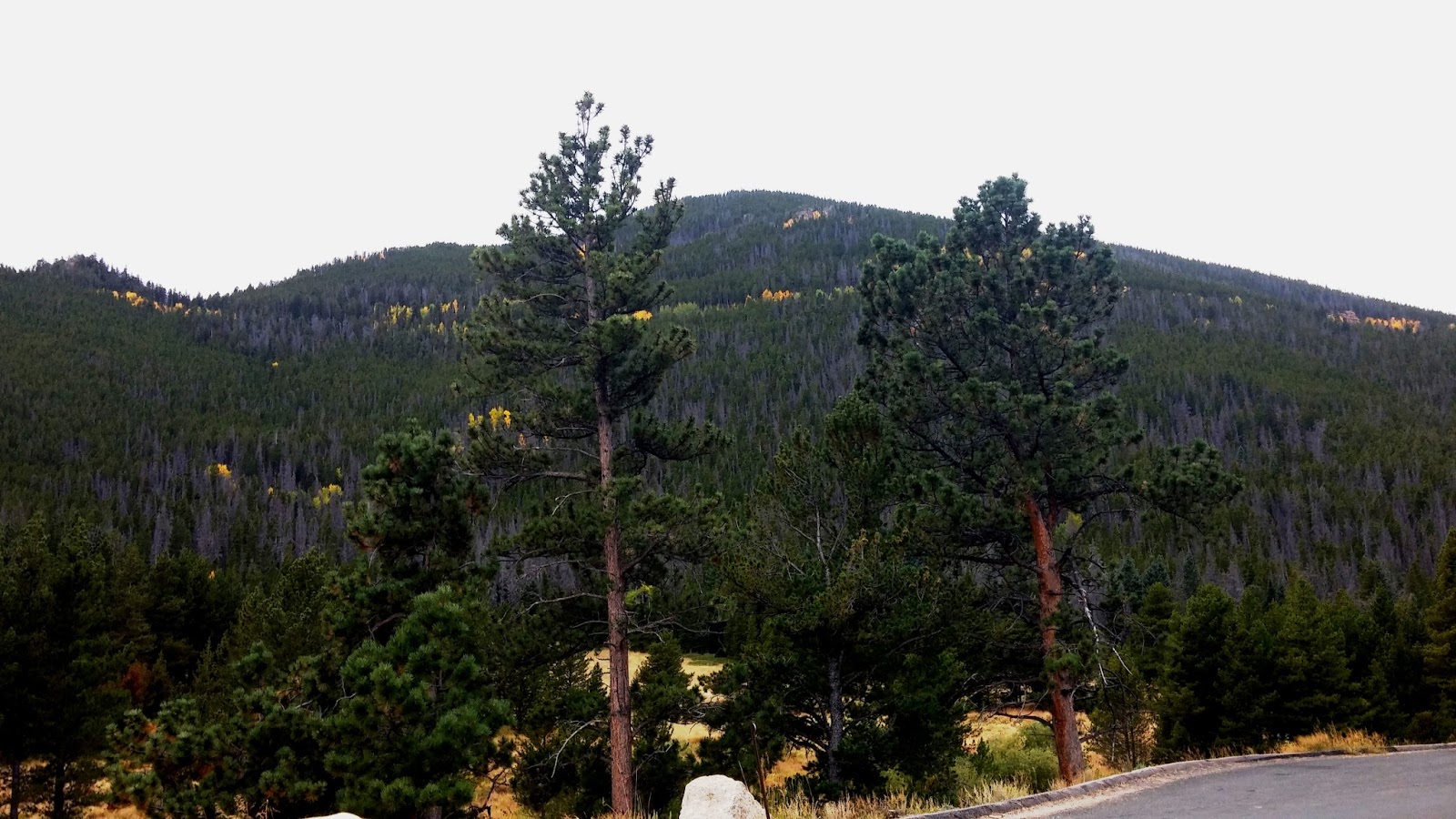
We traveled Trail Ridge Road through Rocky Mountain National Park. It was built in 1931 and covers the 48 miles between Estes Park on the east side and Grand Lake on the west. Eleven miles of the highway are at or near an elevation of 11,500 feet with its highest point at 12.183 feet.

The road is well above the timber line.
Rocky Mountain National Park

Entering Rocky Mountain National Park we were greeted by these natives


The road to the top winds up from the bottom left curves around the center and climbs out the center right.


Remains of last winters snow.

Near the summit is a gift shop hidden in one of the little gullys.

On top.

Looking back along the top of the Trail Ridge Road.


Looking back down the Park from the Rest Stop near the summit.

One of the greeters at the Rest Stop.


Leaving the Trail Ridge and going down to Grand Lake.
The town of Grand Lake, Colorado is situated on the shores of Grand Lake. It is the most extensive natural body of water in Colorado. The town sits at an elevation of 8369 feet and has a population of 447. The town was originally an outfitting supply point for the mining settlements of Lulu City, Teller City, and Gaskill. Today Grand Lake is the west entrance to Rocky Mountain National Park which surrounds the lake and the town on three sides.


Leaving Grand Lake we are following the mighty Colorado River. It isn't very big as it leaves the lake but it will drain most of western Colorado and New Mexico, southwestern Wyoming, eastern and southern Utah, southeastern Nevada and California and nearly all of Arizona. Shirley and I have been to the Grand Canyon on a previous road trip so we now have seen the beginning as well as almost the end of the mighty river.

The mighty Colorado River
It is approximately 90 miles from Grand Lake to Steam Boat Springs, our destination for tonight. With the mountains of the Rocky Mountain National park behind us, we head for the lower valleys. The mountains are not as high, but the fall colors were nice to look at.


Steamboat Springs from the parking lot of our hotel.
Steamboat Springs was a nice little town with a population of about 12,000. It is the home to natural hot springs that are located throughout the area. When early trappers came near the springs, they heard a chugging sound like a steamboat was coming down the river. When the trappers saw there was no steamboat, but the sound was coming from a hot spring, they named the spring Steamboat Springs.
Shirley and I spent several hours visiting the old part of the town (actually we were looking for the place that advertised on the internet to have jelato. Everyone told us that when we got to Steamboat Springs we had to try jelato (Italian Ice Cream). We found the place; but it had moved across town to a new location.
Anyway, we got to see part of Steamboat Springs and have some jelato. To tell you the truth, I think Schwan ice cream is just as good and not as expensive (no fancy name to pay for).
Tomorrow, we will leave for Riverton, Wyoming going through Craig, Colorado, and into Baggs, Wyoming. We will be back in the high mountain desert.
We left Steamboat Springs this morning. We will go to Craig, Colorado; Baggs, Wyoming; take I 80 East to Rawlins, Wyoming; then go north to Muddy Gap, and northwest to Riverton. We will spend the next several days with Shirley's brother Terry and wife Donna. This will complete the loop as we started from Riverton on our extended Road Trip.


From Steamboat Springs to Craig, we followed the Yampa River. The mountains changed to low hills and flat farm and ranch land.

The closer we got to Craig, the more arid the landscape.

Craig, Colorado is a community with a population or about 9,500. In the 1970's and early 80's the largest power generation plant in Colorado and several coal mines were constructed in the area.

Colorado highway 13 is the major highway from Craig to Baggs, Wyoming. Notice the lack of mountains (some little ones in the distance about 7,800 feet in elevation are almost in Utah).

This part of Colorado looks just like southern Wyoming.

Heading for Wyoming on CR 13

Almost to Baggs.


Not much to look at in this part of Wyoming between Baggs and Sweetwater Station. There are a lot of oil and natural gas wells.

Shirley and I have been in this part of Wyoming before, so we kinda blew like the Wyoming wind through this area. On an earlier road trip, we went to Independence Rock, Devil's Gate, the Sun Ranch which is near Martin's Cove, Martin's Cove, the Sixth Crossing of the Sweetwater, Split Rock and Rock Creek. My Grandmother's Grandfather (as a young man) was a member of the Willie Handcart Company which was stranded here. Several of my ancestors are buried in this area.
At Sweetwater Station, we headed for Sand Draw and on to Lander and Riverton.

Beaver Rim and the Wind River Range in the distance.

Entering Riverton, Wyoming.
We arrived in Riverton on Wednesday and left for home on Friday. This is a backtrack of the first part of our 2015 Road Trip from Riverton to Mackay.


Our Arco desert is a pretty sight.

Heading up the Big Lost River Valley. We will be home in Mackay in about 20 minutes. This has been a great adventure. We were gone for a month, traveled 6,665 miles; were in 21 states (22 if you count Idaho) and Washington D.C.
Comments
Post a Comment